Borehole log
software
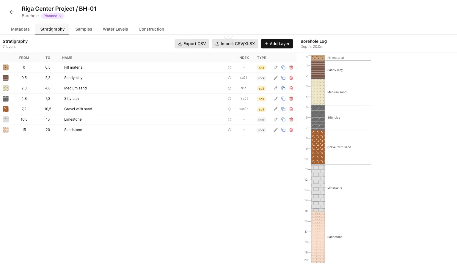
Enter the layers once and Borebase draws the log. Samples, water levels and well construction sit on the same borehole and go to PDF in your company layout.
Describe Layers.
See the Log.
Enter layers by depth and name them with ISO 14688-1 soil terms, rock descriptions or your company's own presets. The log column with hatch patterns is drawn next to the table.
- ✓ISO 14688-1 soil naming
- ✓Rock strength and weathering
- ✓Company classification presets
| Depth (m) | Name |
|---|---|
| 0.00-1.10 | Fill |
| 1.10-3.70 | Sandy clay |
| 3.70-5.70 | Silty clay |
| 5.70-9.10 | Medium sand |
| 9.10-18.90 | Dense sand |
Samples. Water.
Construction.
Record samples, static and dynamic water levels, casing, screens and filter pack on the same borehole. Each gets its own column on the PDF log.
- ✓Samples by depth
- ✓Static and dynamic water levels
- ✓Casing, screens, filter pack and backfill
Your Layout.
Every Log.
Drag columns onto the page in the layout editor, set the page size and depth scale, and save it. Every borehole in the project then exports with the same formatting.
- ✓Drag-and-drop log columns
- ✓Page size, depth scale and logo
- ✓Saved layouts you reuse
Check It Against
the Neighbours.
Compare a borehole with the nearest ones on the site. Layers line up by elevation or depth, water levels run across, and the differences worth a second look are listed for you.
- ✓Align by elevation or depth
- ✓Water levels across boreholes
- ✓Notes on what stands out
Bring Data In.
Take It Out.
Add many boreholes at once from CSV, XLSX, ODS or KML, import stratigraphy from CSV or XLSX, and export objects, samples and stratigraphy as spreadsheets.
- ✓Bulk import from CSV, XLSX, ODS and KML
- ✓Stratigraphy from CSV or XLSX
- ✓Spreadsheet exports for your own tools
 borebase
More in Borebase
Try It on
Your Own Project.
Create a project, add your boreholes and soundings, and export the first report.
No credit card · takes 2 minutes